
You are here: Home page " Danube Panorama Trail: Neustadt an der Donau - Weltenburg section
More about the Danube Panorama Trail!
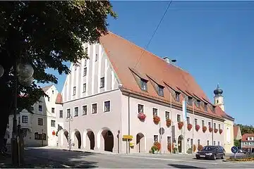
The 220-kilometre Danube Panorama Trail begins in the town of Neustadt a. d. Donau, which has the oldest town charter in Bavaria. You leave Neustadt in a north-easterly direction and soon reach the spa town of Bad Gögging, which is home to the Limes thermal baths and the Roman Museum of Spa and Bathing.
After crossing the Abens, you pass the golf course and walk through the Abensauen and impressive hop gardens towards Eining. Just before the village is the Abusina Roman fort, which marked the transition from the wet to the dry Limes during the Roman Empire. In Eining, you also have the option of taking a detour on the cable ferry to the Limes watchtower. Otherwise, enjoy a break in the beer garden at the cable ferry and fortify yourself for the rest of the stage.
After the Abens flows into the Danube, the landscape changes to Jura slopes with dry grassland. The path now leads you idyllically along the natural Danube towards Weltenburg.
Weltenburg Abbey with its impressive Asam Church is located at the beginning of the Danube Gorge. In the monastery tavern you can taste the beer specialties of the oldest monastery brewery in the world. You can enjoy the sun on the gravel bank of the sloping Danube or watch the small wooden boats, the so-called Zillen.
For the rest of the stage to Kelheim, you can take a boat trip to enjoy the Danube Gorge and the Weltenburger Enge nature reserve in comfort.
If you prefer to reach your destination on foot, there are various hiking routes in the Weltenburger Enge that lead to Kelheim. You can use the forest route, which takes you to the Liberation Hall on the Michelsberg, or you can take the Danube route, which runs along the Danube for most of the way and passes the Klösterl hermitage with its unique rock church. For both hiking routes, you have to cross over to the other bank at Weltenburg Monastery either by boat or by cable ferry. As a third hiking option, you can follow the Weltenburger Höhenweg, which leads steeply uphill in the monastery between the church and the visitor center.
Once you arrive in Kelheim, you can round off the stage in one of the many restaurants, cafés, beer gardens or pubs.
Walking time approx: 5 hours

Public transportation
Then simply contact us at any time using the following contact options:


